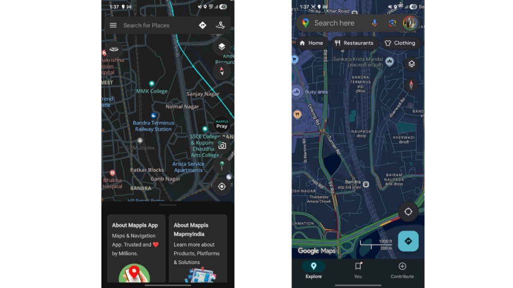
What is Mappls App: Features explained, how is it compared to Google Maps?

In the growing wave of Swadeshi technology, from Zoho’s productivity tools to Arattai’s messaging platform, Mappls has emerged as India’s homegrown answer to global navigation apps. Developed by MapmyIndia, Mappls positions itself not just as a mapping tool but as a navigation ecosystem designed specifically for Indian roads, urban layouts, and rural addresses. With data hosted entirely in India and a focus on user privacy, it caters to a population that increasingly seeks locally relevant solutions.
Also read: What is Zoho: Indian alternative to Google Docs, Sheets, and more
Navigation designed for India
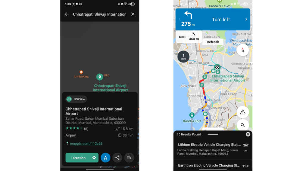
Indian roads are notoriously complex. Multi-level flyovers, underpasses, and junctions in cities like Mumbai, Bengaluru, and Delhi can leave even experienced drivers second-guessing their routes. Mappls addresses this with its 3D junction and flyover views, offering a real-world visual guide that makes navigating these intersections far simpler. Google Maps, by contrast, relies mostly on 2D directions, which can be insufficient in such environments.
Beyond the streets, Mappls supports indoor navigation, helping users find their way in malls, airports, and multi-story complexes. Google Maps offers similar functionality only at select international venues, leaving a gap for India-specific indoor guidance. Combined with hyperlocal data, including house numbers in semi-urban and rural regions, Mappls ensures users can rely on it for navigation even where Google Maps may falter. The Mappls PIN (DigiPin) system further simplifies sharing locations in areas with unclear addresses, making deliveries, emergency responses, and day-to-day travel much more reliable.
Real-time traffic and safety features
Mappls also focuses on safety and context-sensitive navigation. It provides real-time updates on traffic congestion, accidents, potholes, speed breakers, and even live traffic signal timings at select intersections. Community-sourced reports allow users to contribute local hazard information, keeping the map accurate and up to date. Google Maps, while excellent at predicting traffic congestion, lacks these hyperlocal alerts and hazard-specific notifications, giving Mappls a clear advantage for Indian road conditions.
Vehicle tracking, geofencing, and over-speed alerts are integrated into the platform through IoT support, further enhancing Mappls’ utility for personal and commercial use. These features collectively make Mappls not just a map but a comprehensive navigation solution built with Indian users in mind.
Government collaboration and privacy
A crucial differentiator for Mappls is its alignment with government initiatives and privacy standards. Data is hosted in India, complying with local regulations and requiring minimal permissions from users. Integration with platforms like UMANG and collaborations with law enforcement for traffic monitoring provide additional credibility and practical benefits.
Also read: How Arattai, Zoho Apps are ‘Made in India’: Sridhar Vembu explains in detail
Union Minister Ashwini Vaishnaw has publicly endorsed Mappls as a Swadeshi alternative to Google Maps, highlighting its role in India’s digital self-reliance initiatives. There are also proposals to pre-install the app on smartphones manufactured under the PLI scheme, reflecting the government’s push for widespread adoption. Google Maps, by contrast, operates on international servers and has limited integration with Indian government platforms.
Feature comparison: Mappls vs Google Maps
| Feature | Mappls (MapmyIndia) | Google Maps |
| 3D Junction/Flyover View | Clear visuals for complex Indian intersections | Standard 2D directions with instructions like “Take flyover” |
| Hyperlocal Coverage | Strong in urban, semi-urban, and rural India | Strong urban coverage; rural coverage inconsistent |
| Live Traffic & Hazards | Alerts for potholes, speed breakers, signals, accidents | General traffic congestion alerts and accidents |
| Indoor Navigation | Available in malls, airports, complexes | Limited, only at select global venues |
| Digital Address System | Mappls PIN / DigiPin | No built-in digital address code |
| Data Privacy & Storage | Hosted in India, minimal permissions | Hosted internationally, broader permissions |
| App UI/UX | Functional, India-centric | Sleek interface, globally familiar |
| EV Routing & Fuel Estimation | Supports Indian EV charging stations and fuel costs | Available only in select markets |
While the table offers a quick overview, the differences become even clearer in practice. On urban streets, Mappls’ 3D junction views and traffic signal timers reduce confusion at multi-level intersections, whereas Google Maps relies on generalized 2D navigation. For rural or semi-urban travel, Mappls’ hyperlocal accuracy and Mappls PIN ensure reliable guidance where Google Maps coverage can be inconsistent. Safety-conscious users also benefit from Mappls’ pothole, speed breaker, and accident alerts, features largely absent in Google Maps. Indoor navigation, IoT integration, and EV-specific routing further emphasize Mappls’ practical advantages for Indian users.
Who should use Mappls
Mappls is especially suitable for Indian users navigating semi-urban or rural areas, commuters seeking hyperlocal traffic and hazard updates, or those concerned about data privacy and government-aligned features. Google Maps remains the go-to app for global travel, metro navigation with extensive POI coverage, or when users prioritize interface smoothness and worldwide familiarity.
Mappls is more than a mapping app, it’s a navigation ecosystem built for India. With its 3D junction views, hyperlocal coverage, Mappls PIN, real-time traffic and safety alerts, indoor navigation, and government integration, it addresses challenges that global platforms often overlook. While Google Maps continues to dominate internationally with a polished interface and vast database of locations, Mappls offers practical, locally relevant solutions tailored to the realities of Indian roads.
For users navigating India’s complex urban streets, remote villages, or indoor complexes – or those seeking privacy-conscious, government-supported solutions – Mappls emerges as a compelling, Swadeshi alternative, proving that homegrown technology can compete with global giants.
Also read: Arattai vs WhatsApp: Major differences, feature comparison and everything else you should know