Google Earth will now offer sharper images via Landsat 8 satellite
The company says that the new satellite captures images in greater detail and in truer colours

Satellite imagery for Google Earth will now be available in much higher detail as the company will now utilise the Landsat 8 satellite. The satellite was launched into orbit in 2013 and Google says that it captures images in greater detail and in truer colours. Further, the company claims that the new satellite will be able to capture twice as many images per day as compared to its predecessor, the Landsat 7. This will also affect Google Maps as it also uses satellite imagery from Google Earth.
Google Earth’s previous mosaic of satellite images only used images from the Landsat 7, however, the company notes in its blog that the satellite suffered from a hardware failure in 2003. This resulted in large diagonal gaps of missing data. The company also adds that the company mined data from almost a petabyte of imagery taken by the landsat 8, which consisted of 700 trillion individual pixels. “To put that in perspective, 700 trillion pixels is 7,000 times more pixels than the estimated number of stars in the Milky Way Galaxy, or 70 times more pixels than the estimated number of galaxies in the Universe,” said Chris Herwig, Program Manager, Google Earth Engine.
Google also says that it used the publicly available Earth Engine APIs to produce the imagery. It adds that scientists also use the same API to track global tree cover, predict Malaria outbreaks and more.
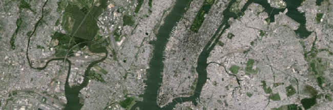
Before Landsat 8
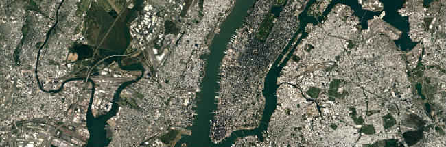
After Landsat 8
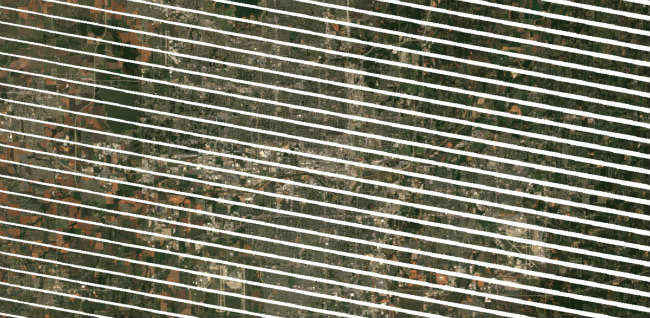
Landsat 7 hardware failure